
Start with the Kiama history timeline
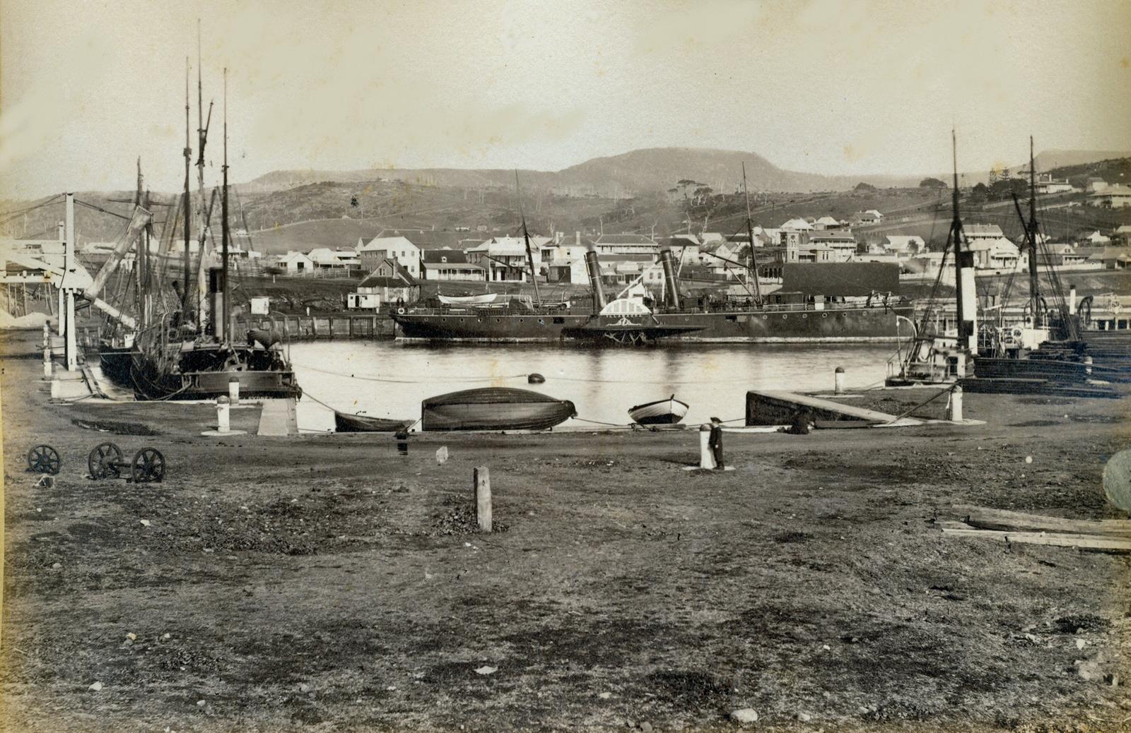
Kiama's story is easy to follow on foot, because so much of it is still standing within a few streets of the harbour. Here are the dates the local and official sources agree on.
| Traditional Custodians | The Wodi Wodi people, who spoke a variant of the Dharawal language |
|---|---|
| December 1797 | George Bass sails past and records the Blowhole |
| From about 1810 | Cedar getters cut red cedar on the South Coast for Sydney |
| 1826 and 1839 | Town site reserved, then the town plan approved |
| 1855 | John Carson arrives, one of Kiama's first quarrymen |
| 1876 | Robertson Basin (Kiama Harbour) completed |
| 1880 and 1881 | Post office opens on Terralong Street; Pilot's Cottage built |
| 1884 | Australia's first cooperative butter factory opens near Spring Creek |
| 1 January 1887 | Kiama Lighthouse first lit |
| 2 June 1893 | First train reaches Kiama station |
| From Kiama Ridge Waters | Town heritage precinct about a 34-minute walk (2.8 km) or a 4-minute drive |
Dates come from Kiama Library's local history pages, Destination Kiama and the NSW State Heritage Register. Where sources differ, we say so below.
Acknowledge Dharawal Country and the Wodi Wodi people
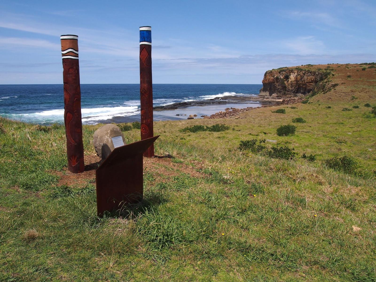
Kiama is on Dharawal Country. Kiama Library describes the Wodi Wodi as the First Nations custodians of the Illawarra, speaking a variant of the Dharawal language. Kiama Council pays its respects to the Traditional Custodians of the Dharawal Nation and their Elders past, present and future.
The library lists several possible meanings for the name Kiama, among them "where the seas roar" and "fish caught from rocks". Destination Kiama says Aboriginal people knew the Blowhole as the place "where the sea makes a noise". Our Kiama Blowhole guide covers the names recorded by other official sources.
Close to Kiama Ridge Waters, a Council plaque at the Little Blowhole tells the story of Gurrungutch, the Great Giant Eel, as shared by Tharawal Illawarra man Aaron Broad. It links to Cathedral Rocks, north of Bombo. Council has also installed 11 signs across the area acknowledging Dharawal Country, with artwork by Wodi Wodi Elder Aunty Jodie Stewart.
To learn more, start with First Nations Kiama at Kiama Library and Kiama Council's First Nations Country project. The library notes some historical records use words that may offend.
Follow the cedar getters and dairy farmers
Kiama Library says red cedar from the South Coast was reaching Sydney from around 1810, and the first cedar getters were usually convicts and ticket-of-leave men. David Smith, described as Kiama's first European settler, began cutting cedar here in 1821. Kiama, Gerringong and Shellharbour were the ports that shipped the logs. By the 1850s the local cedar was running out and the cutters had moved to northern NSW.
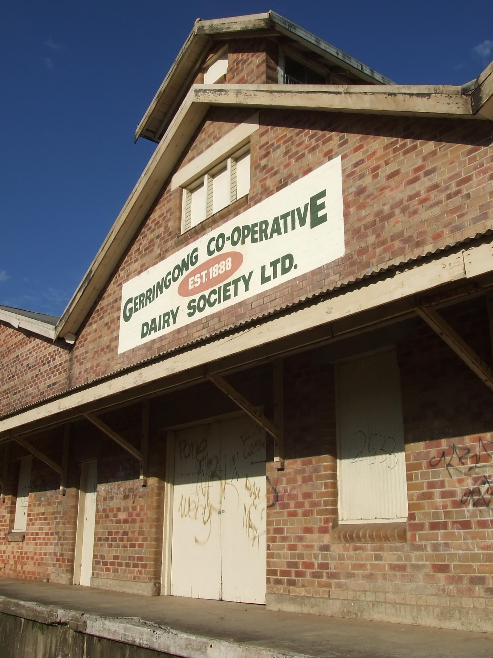
Cleared land became dairy country. The library records that the first cooperative butter factory in Australia opened in 1884 on a bend near Spring Creek, on the road to Jamberoo. The building was demolished in 1936, and a 1962 monument topped with a replica butter keg marks the site. Destination Kiama points to the dry stone walls on Saddleback Mountain Road as another trace of this farming past. Pair them with a visit to Saddleback Mountain or the village of Jamberoo.
See how basalt built the harbour
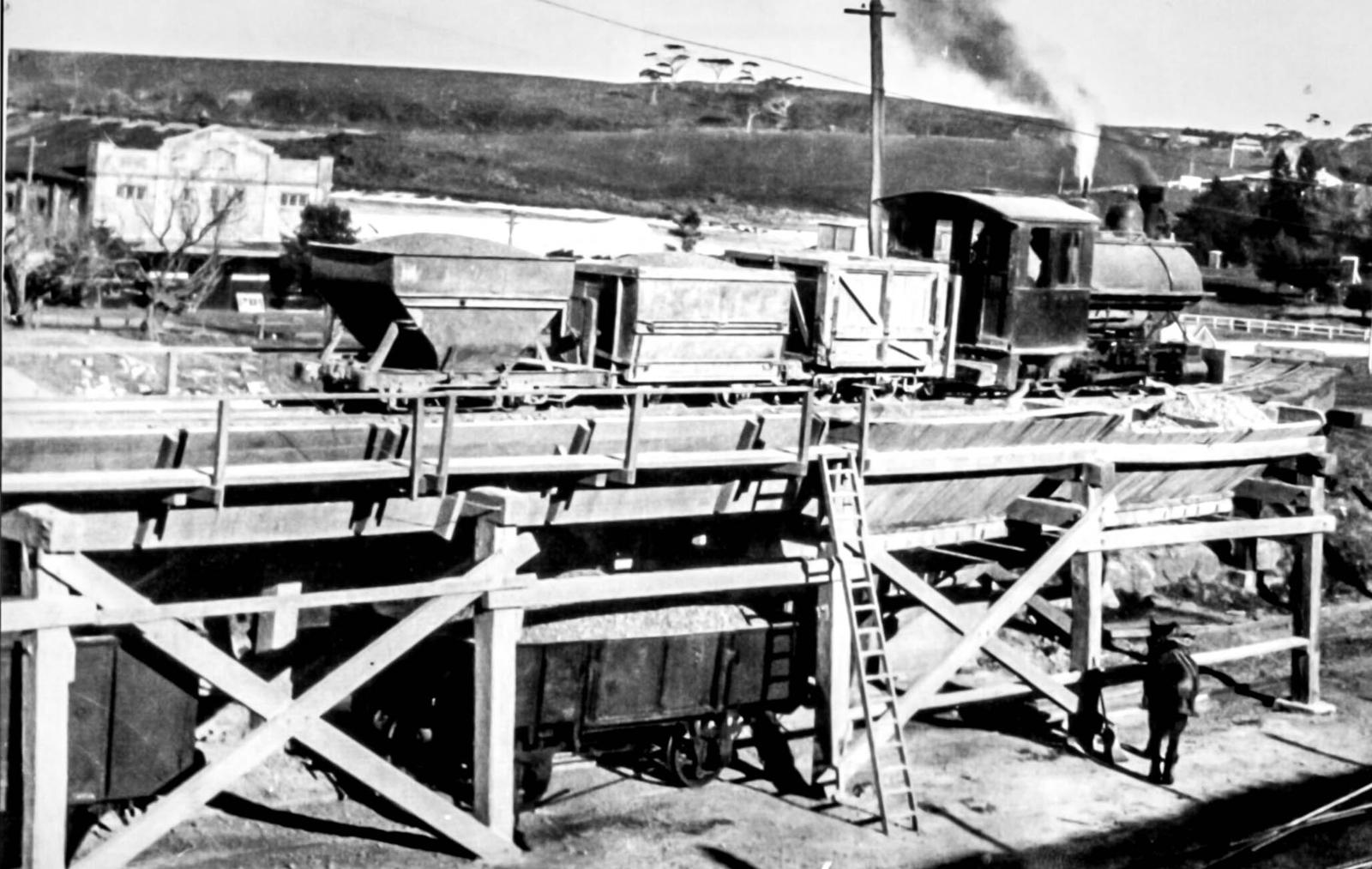
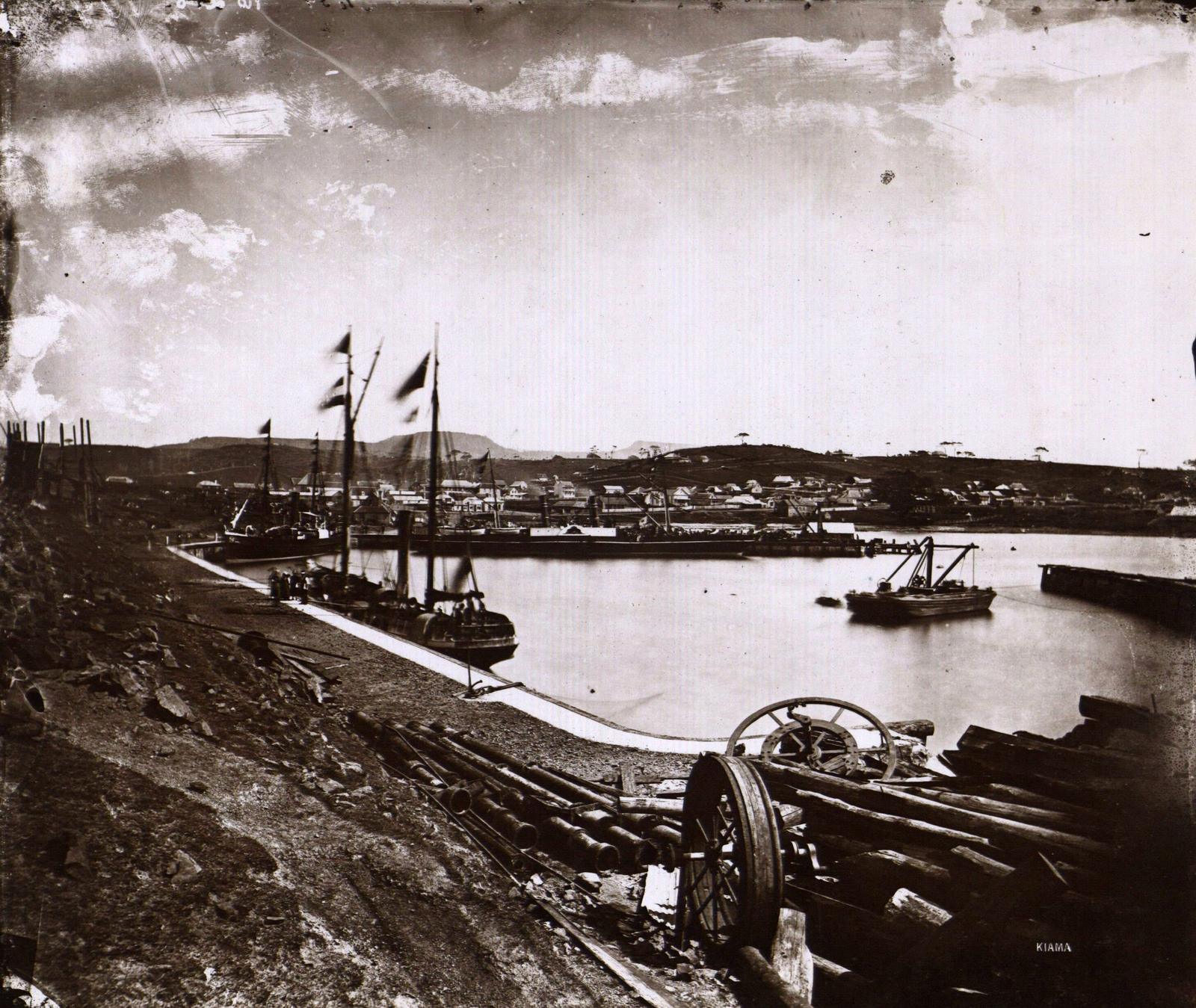
Basalt, sold as blue metal for roads and railways, made Kiama a working town. Kiama Library says John Carson began quarrying Pike's Hill after arriving in 1855, and his brother William opened the Bombo Headland quarry in 1881. In the 1880s steam crushers arrived, and Kiama became the main supplier of blue metal to the colony.
Stone first went down Terralong Street by dray and was shovelled into ships by hand. A tramway later carried it to hoppers at the harbour. The old quarry at Bombo Headland is now on the NSW State Heritage Register as a geological site; see our Bombo guide.
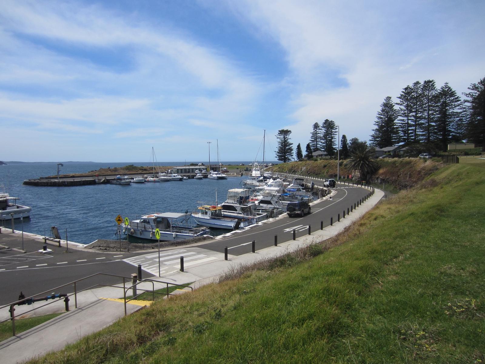
The quarries needed a safe harbour. Destination Kiama says Robertson Basin was completed in 1876 after 16 years of work, and the library's heritage plaque says it was opened that year by Miss Charles on the deck of the steamer Hunter. Read more in our Kiama Harbour guide.
Visit the lighthouse and the Pilot's Cottage Museum
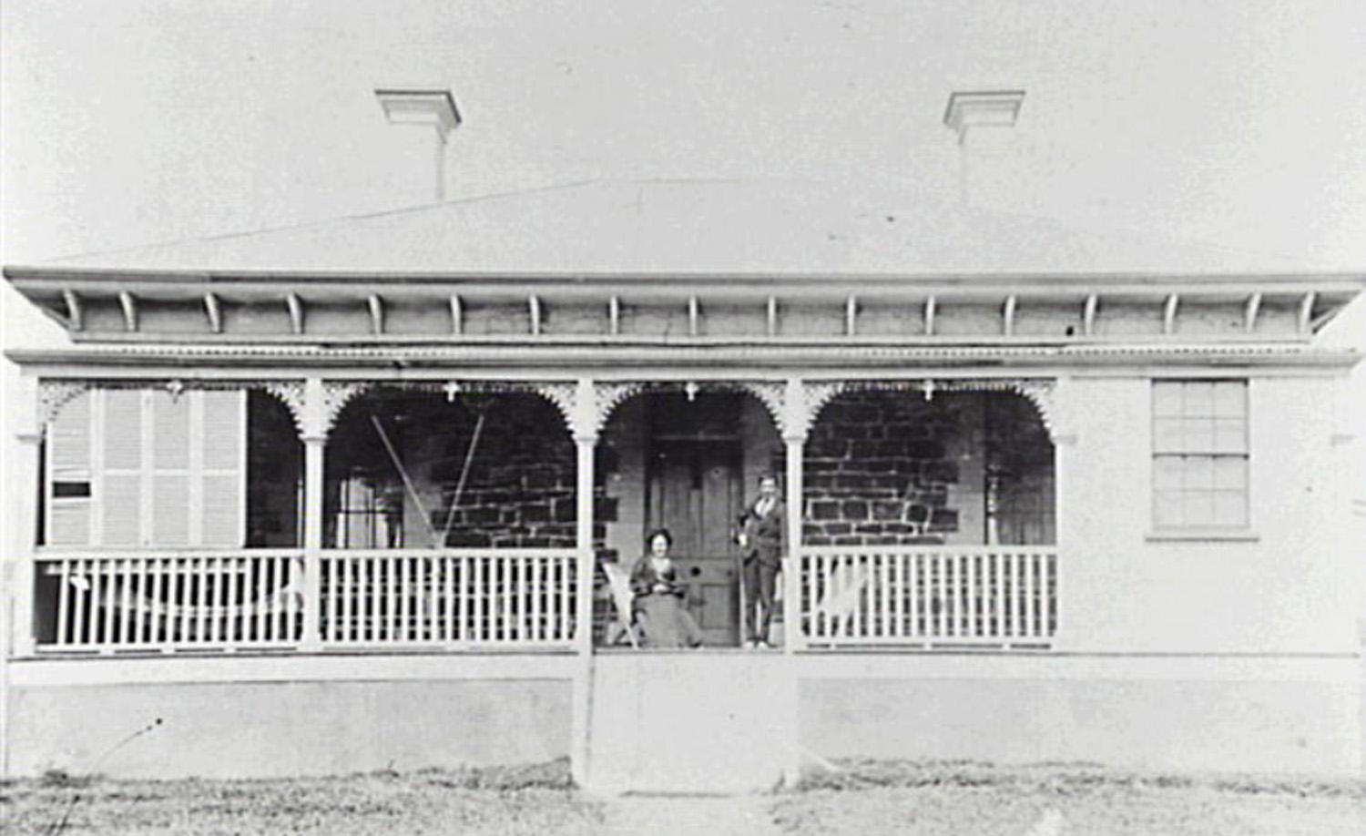
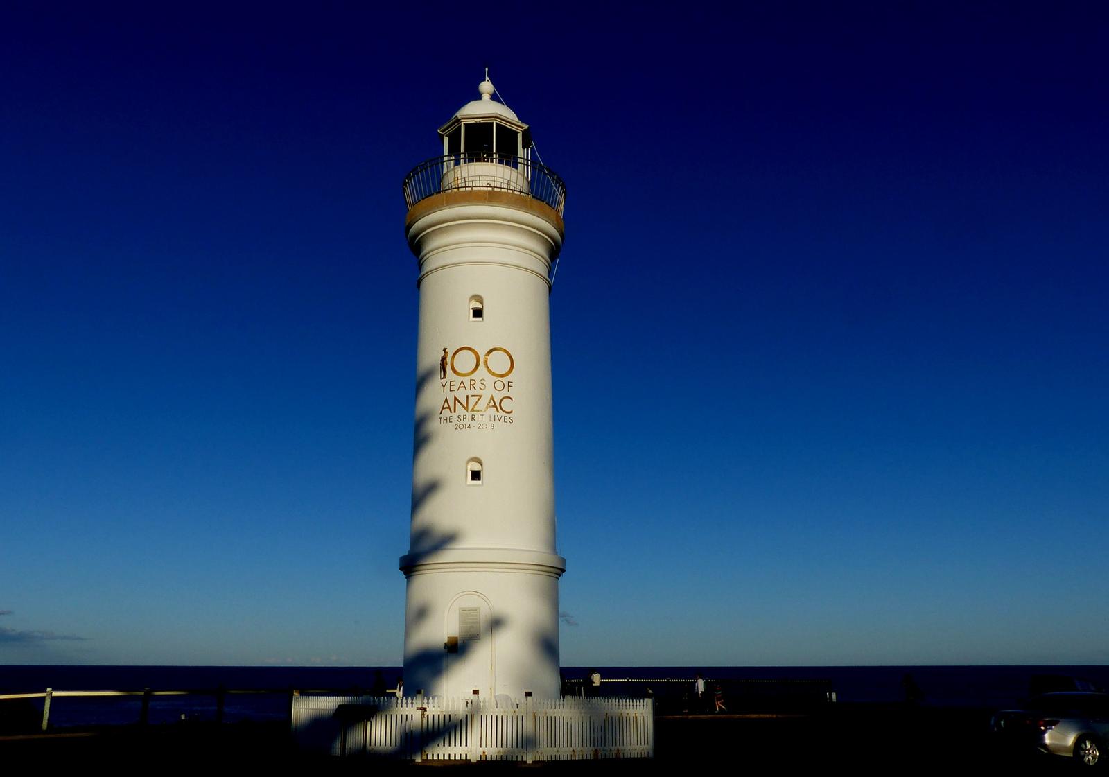
More ships meant the town needed a light. Kiama Library says Kiama Lighthouse was first lit on 1 January 1887 on Blowhole Point. Our Kiama Lighthouse guide has the full story of its lamps.
Just below it is the Pilot's Cottage, built in 1880 and 1881 with basalt walls. The library says it was home and office to Kiama's harbour pilots from 1881 until the last pilot retired in 1978, and the Kiama Historical Society restored it in 1984 and 1985. It is now the society's museum, covering shipping, the cedar industry and the basalt quarries.
Opening hours: Destination Kiama lists Saturday and Sunday, 11am to 3pm. The Kiama Historical Society says the museum has recently opened on more days around the weekend. Check before you go on 02 4232 2492 or at kiamahistory.com. The listing says disabled access is available; contact the operator for details.
Walk past Kiama's heritage-listed buildings
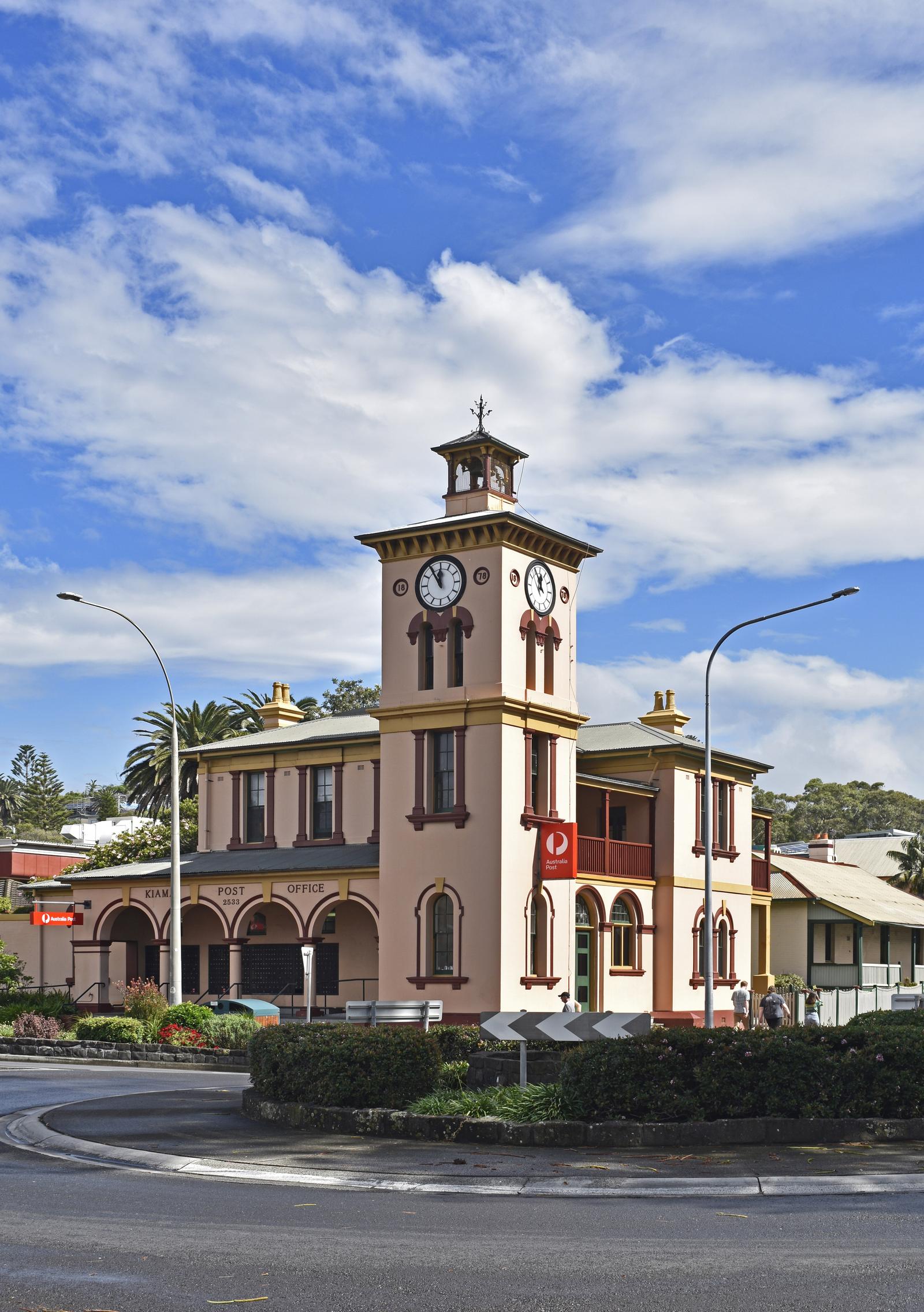
Several buildings in the town centre are on the NSW State Heritage Register. You can see all of them from the street in under an hour.
- Collins Street wooden terraces: two rows at 24 to 40 and 42 to 44 Collins Street, built in stages from the late 1870s for quarry workers. No. 24 began as an inn and No. 40 as a post office, according to Kiama Library.
- Masonic Temple, 46 Collins Street: built in the 1870s as a Temperance Hall, next to the terraces.
- Scots Presbyterian Church, Shoalhaven Street: designed by Thomas Rowe and built from 1860 to 1863.
- Former CBC Bank, 16 to 20 Manning Street: an Italianate bank of about 1880 by Mansfield Bros.
- Kiama Post Office, 24 Terralong Street: Kiama Library says it opened for business on 19 January 1880. Its corner clock tower is a town landmark.
- Kiama Railway Station group: listed with its platform building and turntable.
The 1861 Court House stands beside the post office on Terralong Street. These are working buildings, so admire them from the footpath unless they are open to the public.
Browse the Collins Street terraces
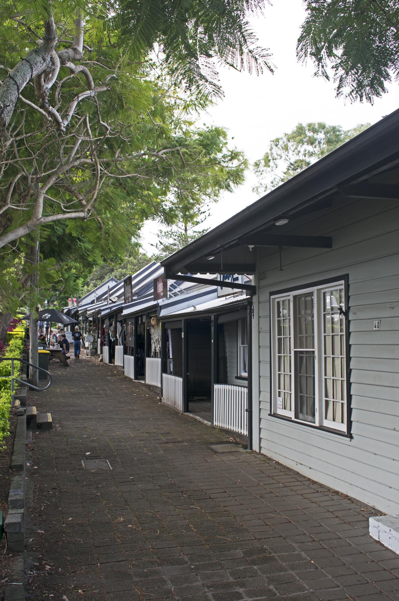
The terraces are the heritage stop most visitors remember, because you can go inside: the old cottages now hold cafes, restaurants and small shops. Kiama Council's 2009 plaque says they were built for quarry workers and their families, at a time when the work was hard and accidents were common. Destination Kiama gives the date as 1886, while Kiama Library's history page says builder William Geoghegan, a wharfinger, put up the first row in the late 1870s and the rest during the 1880s.
The plaque records that by the 1960s the terraces were close to being demolished, before the National Trust classified them and a permanent conservation order protected them. For a coffee or a meal here, see Kiama cafes.
Follow the trains to Kiama station
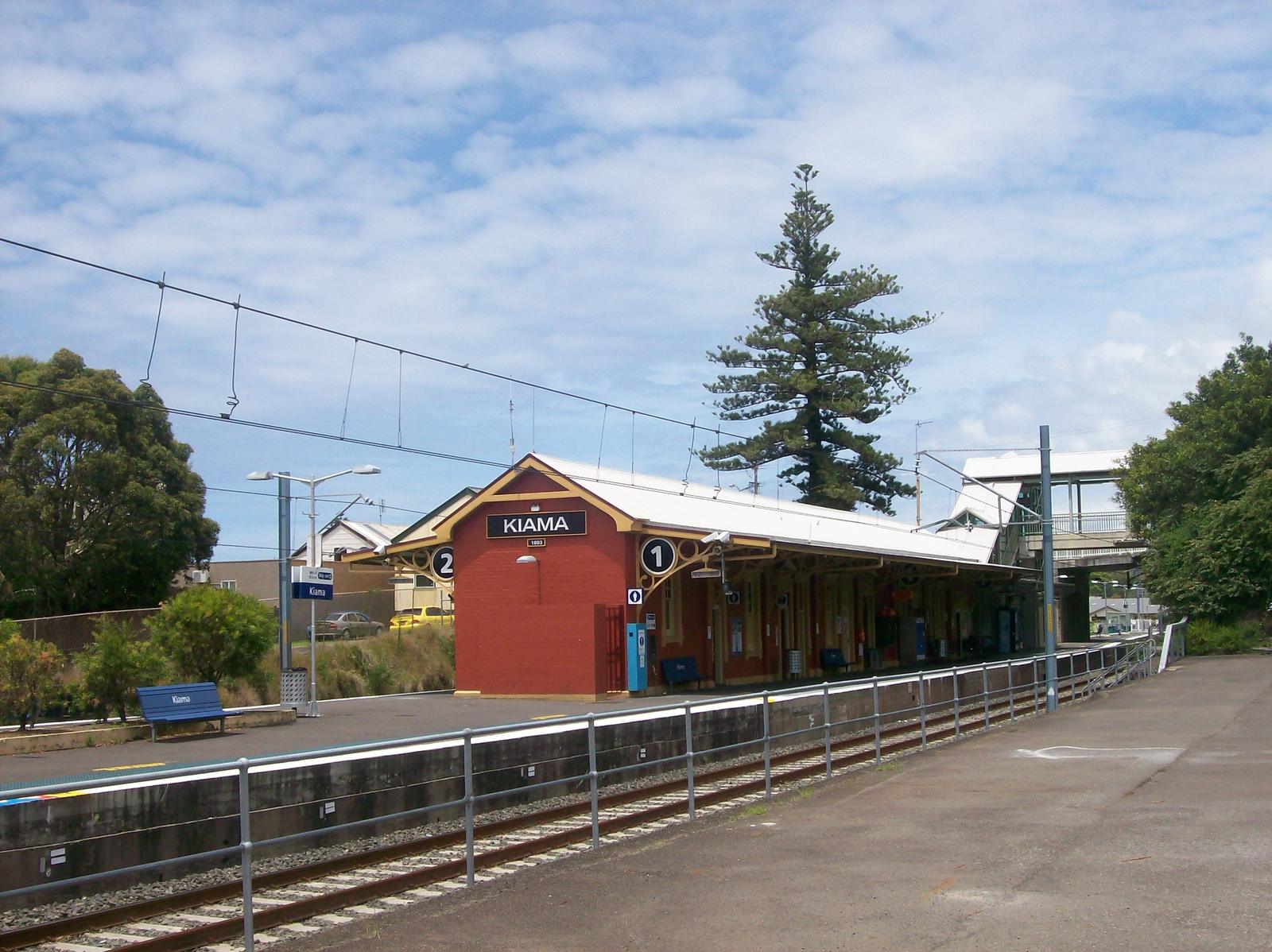
Kiama Library says the first train entered Kiama station on 2 June 1893, when the line south to Bomaderry opened. The station building was designed by Henry Deane, and the library notes the railway eased many of the problems facing Kiama's dairy farmers. The station group, including its turntable, is on the State Heritage Register.
Kiama Library sits across from the station, and Destination Kiama lists the Kiama Family History Centre on Railway Parade for anyone tracing family links to the district. Steam still visits on some weekends: see our Kiama Picnic Train guide.
Take the self-guided Kiama heritage walk
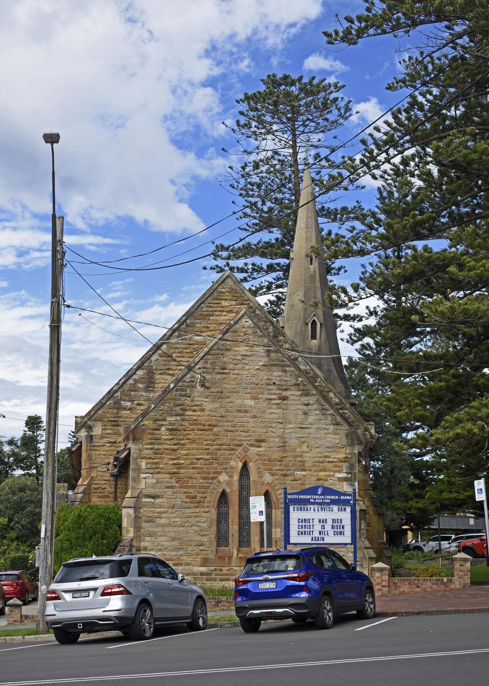
This route links the main heritage sites on foot from Kiama Ridge Waters. It is mostly footpaths, with Kiama's steep streets in places. Allow about 1 hour 35 minutes of walking (7.4 km) for the full loop, plus time at each stop. If you drive in, the town loop from the terraces to the station is about 32 minutes on foot (2.5 km).
| Stop | What to see | Walk from the last stop |
|---|---|---|
| 1. Collins Street | Wooden terraces and the Masonic Temple | 34 min (2.8 km) from Kiama Ridge Waters |
| 2. Shoalhaven Street | Scots Presbyterian Church | 4 min (0.3 km) |
| 3. Manning Street | Former CBC Bank | 4 min (0.3 km) |
| 4. Terralong Street | Post Office and Court House | 1 min (0.1 km) |
| 5. Kiama Harbour | Robertson Basin and its plaque | 5 min (0.4 km) |
| 6. Blowhole Point | Pilot's Cottage Museum | 5 min (0.3 km) |
| 7. Blowhole Point | Kiama Lighthouse and the Blowhole | 3 min (0.2 km) |
| 8. Railway Parade | Kiama station and Kiama Library | 10 min (0.8 km) |
| Home | Back to Kiama Ridge Waters | 28 min (2.2 km) |
For the First Nations story, make a separate stroll to the Little Blowhole and its Gurrungutch plaque, about a 20-minute walk (1.6 km) from the apartments; see our Little Blowhole guide. For more detail on the way, Kiama Library offers free self-guided tours in its Kiama Library Tours app, including a 2.3 km First World War walk. Destination Kiama says a Heritage Walks brochure is available from the Visitor Information Centre on Blowhole Point. For other routes, see walks in Kiama.
Stay close to Kiama's history
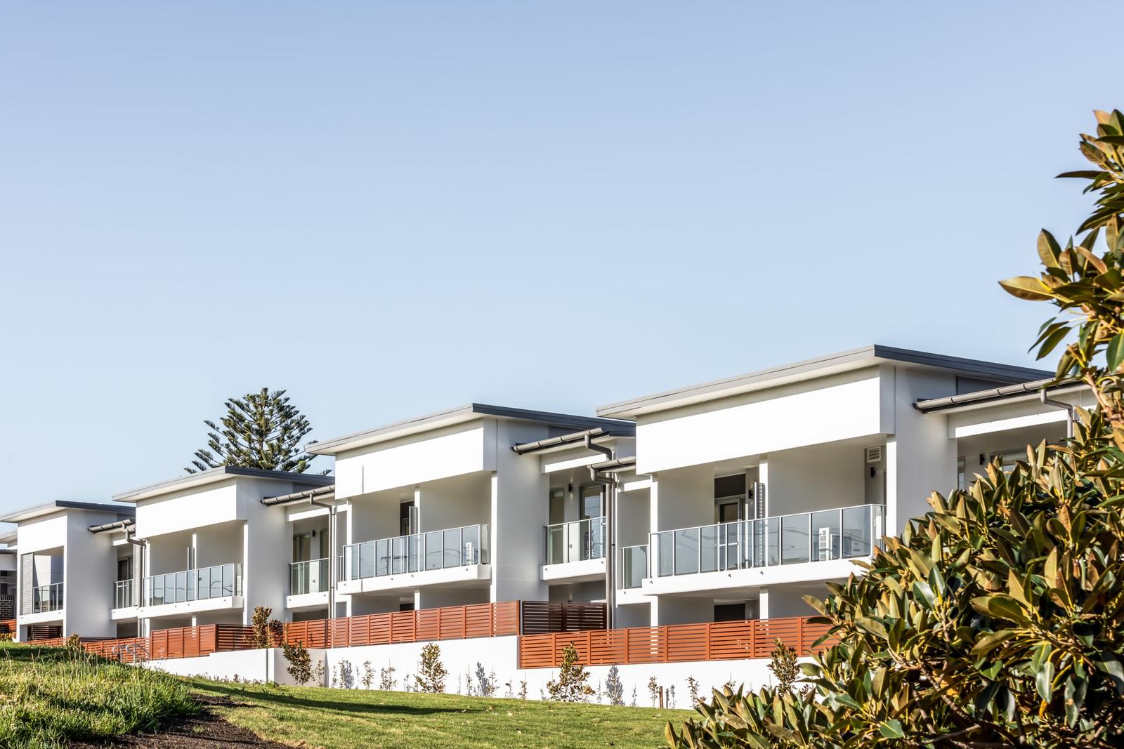
Come back from the heritage walk to room to spread out at Kiama Ridge Waters. Each of our three-bedroom apartments at 2 Surfleet Place sleeps six, with two bathrooms, a full kitchen, a laundry and garage parking for two cars. The heritage precinct is about a 34-minute walk or a 4-minute drive, and the Little Blowhole is 20 minutes away on foot.
Most of our apartments welcome pets (a $200 cleaning fee applies), and groups can book several together. See our three-bedroom apartments in Kiama, family accommodation and group stays, or check availability. On a wet day, our guide to rainy day things to do in Kiama puts the museum and library on the list.
Quick answers
Whose Country is Kiama on?
Kiama is on Dharawal Country. Kiama Library describes the Wodi Wodi people as the First Nations custodians of the Illawarra, speaking a variant of the Dharawal language. Kiama Council pays its respects to the Traditional Custodians of the Dharawal Nation and their Elders past, present and future.
What does the name Kiama mean?
No single meaning is settled. Kiama Library lists several possibilities, including "where the seas roar", "fish caught from rocks" and a name linked to the father spirit of eastern NSW. Destination Kiama says Aboriginal people knew the Blowhole as the place "where the sea makes a noise".
When was Kiama Harbour built?
Robertson Basin, the main part of Kiama Harbour, was completed in 1876. Destination Kiama says the work took 16 years, and Kiama Library's heritage plaque records that it was officially opened that year. Ships then loaded crushed basalt there, and the lighthouse on Blowhole Point followed in 1887.
Is the Pilot's Cottage Museum open?
Destination Kiama lists the Pilot's Cottage Museum on Blowhole Point as open Saturday and Sunday, 11am to 3pm. The Kiama Historical Society, which runs it, says it has recently opened on more days around the weekend. Hours change, so call 02 4232 2492 before you go.
Why were the Collins Street terraces built?
They were built to house quarry workers and their families during Kiama's blue metal boom. Kiama Library says No. 24 began as an inn and No. 40 as a post office. Destination Kiama dates them to 1886, while the library says the first row went up in the late 1870s.
Which Kiama buildings are on the State Heritage Register?
In the town centre, the NSW State Heritage Register includes the Collins Street wooden terraces, the Masonic Temple, Scots Presbyterian Church, the former CBC Bank, Kiama Post Office and the Kiama Railway Station group. The Bombo Headland quarry is listed as a geological site north of town.
How long does the Kiama heritage walk take?
Our full loop from Kiama Ridge Waters takes about 1 hour 35 minutes of walking (7.4 km), plus time at each stop. If you drive in and park, the town section from the Collins Street terraces to Kiama station is about 32 minutes on foot (2.5 km).
Sources and useful links
- Kiama Library: First Nations Kiama
- Kiama Council: Acknowledgement of First Nations Country project
- Kiama Library heritage plaque: Gurrungutch the Great Giant Eel
- Destination Kiama: History and heritage
- Kiama Library: Cedar getters
- Kiama Library: Kiama, a township emerges
- Kiama Library: The Pioneer Butter Factory
- Kiama Library: Quarrying in Kiama
- Kiama Library heritage plaque: Robertson Basin
- Destination Kiama: Kiama Harbour listing
- Kiama Library: Kiama Lighthouse
- Kiama Library: Pilot's Cottage
- Destination Kiama: Pilot's Cottage Museum listing
- Kiama Historical Society
- Kiama Library heritage plaque: Timber terraces for stone workers
- Kiama Library: Terrace houses
- Destination Kiama: Historic Terrace Houses listing
- NSW State Heritage Inventory: Wooden Terraces, Collins Street
- NSW State Heritage Inventory: Masonic Temple
- NSW State Heritage Inventory: Scots Presbyterian Church
- NSW State Heritage Inventory: CBC Bank (former)
- NSW State Heritage Inventory: Kiama Post Office
- NSW State Heritage Inventory: Kiama Railway Station Group and Turntable
- Kiama Library: Kiama Railway Station
- Kiama Library: Walking tours